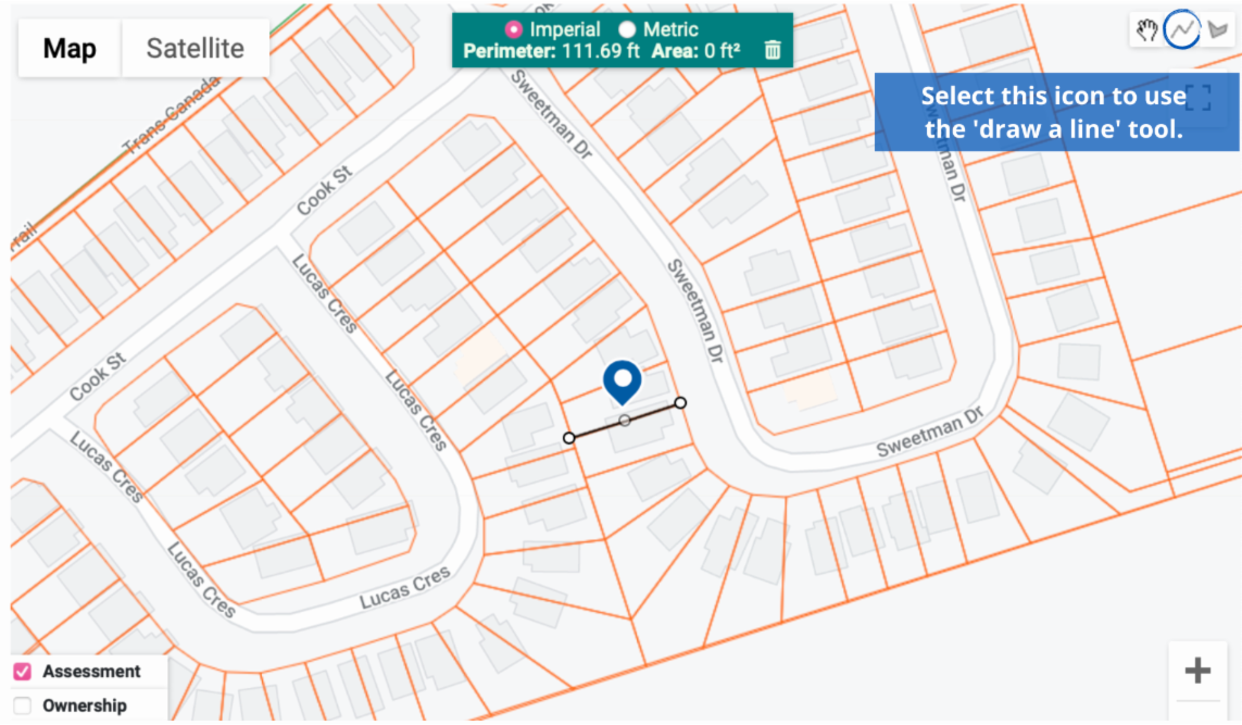
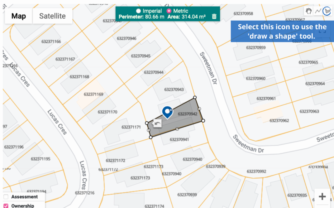
MPAC has added new measuring tools to the map feature in their propertyline™ application.
While using the Assessment or Ownership mapping layers, users can access two new measuring tools. The “Draw a Line” tool allows users to measure the distance between two selected points and the “Draw a Shape” tool allows users to measure the total area within your selected perimeters.
Located in the top right-hand corner of the map, these new tools will allow you to measure a general distance or area in either imperial or metric.
Example of the ‘Assessment’ layer using the ‘Draw a line’ option with an imperial measurement:
Example of the ‘Ownership’ layer using the ‘Draw a shape’ option with a metric measurement:
If you experience any technical issues with the new features, please send an email to propertyline [at] mpac.ca (propertyline[at]mpac[dot]ca).